As part of the ongoing work for restoration in the Bear Creek Corridor, RVCOG has created a series of maps for use in meetings, reports, and for general discussion with partners and the community.
Restoration Mapping
Map Links
Bear Creek Restoration (Clean Water Act (TMDL) Sites, Bear Creek Restoration Initiative (BCRI) Priorities, Bear Creek Natural Resources Plan Restoration Conditions) – link.
Restoration Map Themes:
Restoration
Invasive Species Map
How to Use the Interactive Maps
The image below shows an example from the riparian interactive map. Click on the numbers to learn more about the features and how to use the map.
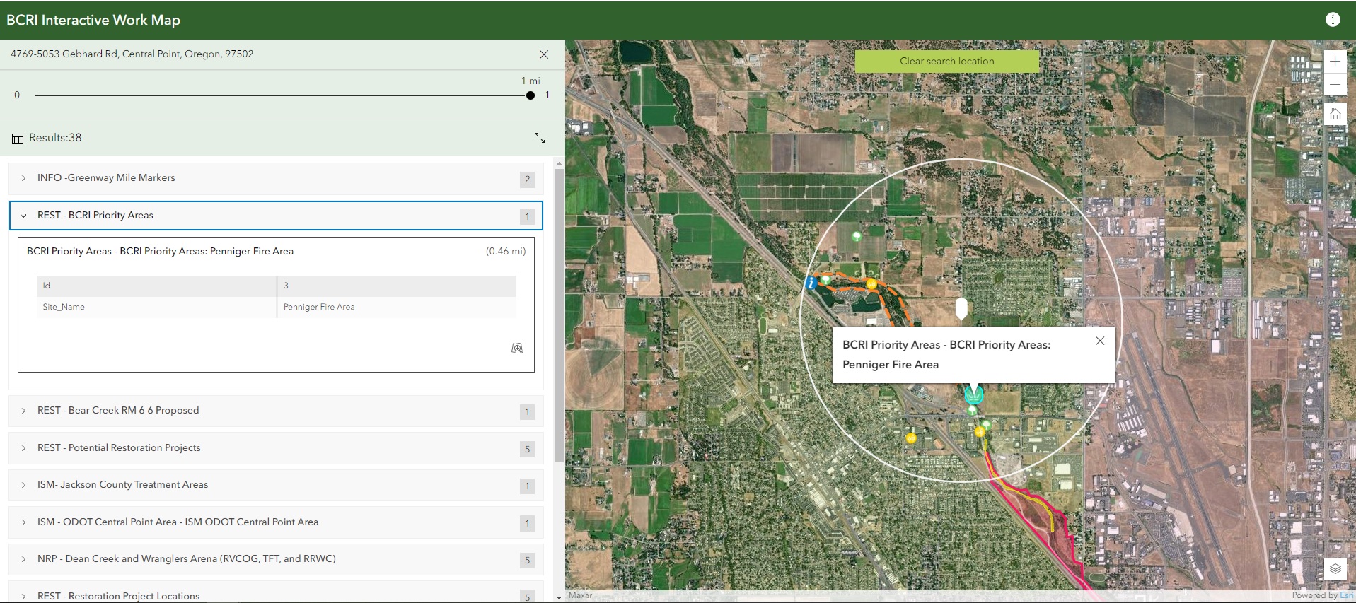
Click on an area to identify a 1 mile radius search area(white circle). The search area will contain all the data from layers located in that section.
Shows selected layer information on the map with the detail. In this example, the Penninger fire area is shown from the BCRI Priority layer.
The items here are the layers that can be selected and shown in the picture. you can toggle through the layers and select by clicking on them.
ISM is short for invasive species management. Layers identified with this text represent invasive species management related layers.
NRP is data from the Natural Resources Plan.