Rogue Valley Council of Governments
As part of the ongoing work for restoration in the Bear Creek Corridor, RVCOG has created a series of maps for use in meetings, reports, and for general discussion with partners and the community.
As part of the ongoing work for restoration in the Bear Creek Corridor, RVCOG has created a series of maps for use in meetings, reports, and for general discussion with partners and the community.
Bear Creek Restoration (Clean Water Act (TMDL) Sites, Bear Creek Restoration Initiative (BCRI) Priorities, Bear Creek Natural Resources Plan Restoration Conditions) – link.
Restoration Map Themes:
Restoration
Invasive Species Map
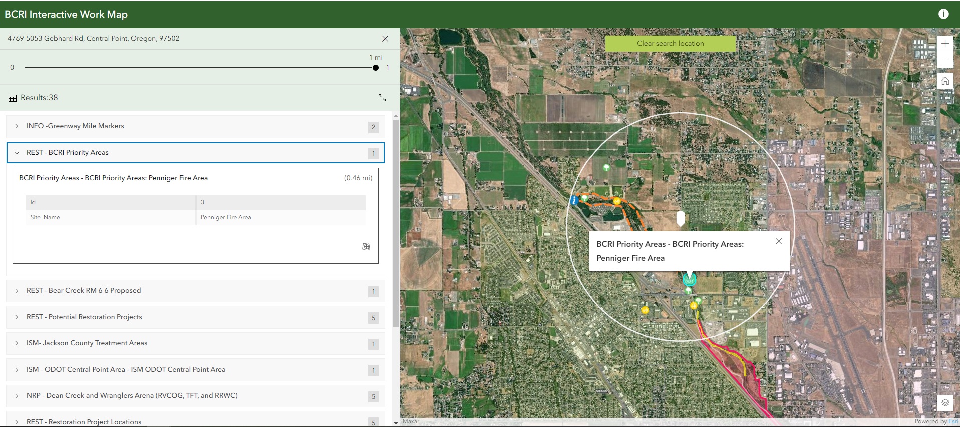
The image below shows an example from the riparian interactive map. Click on the numbers to learn more about the features and how to use the map.