National Water Quality Inventory (NWQI) Project
The September 2021 Obenchain Fire impacted three of the project area subwatersheds.
The project area consists of a wide range of land ownership, with the greatest percentage being private.
The Rogue River runs through the watershed. Several water intakes draw water from the Rogue for drinking water,

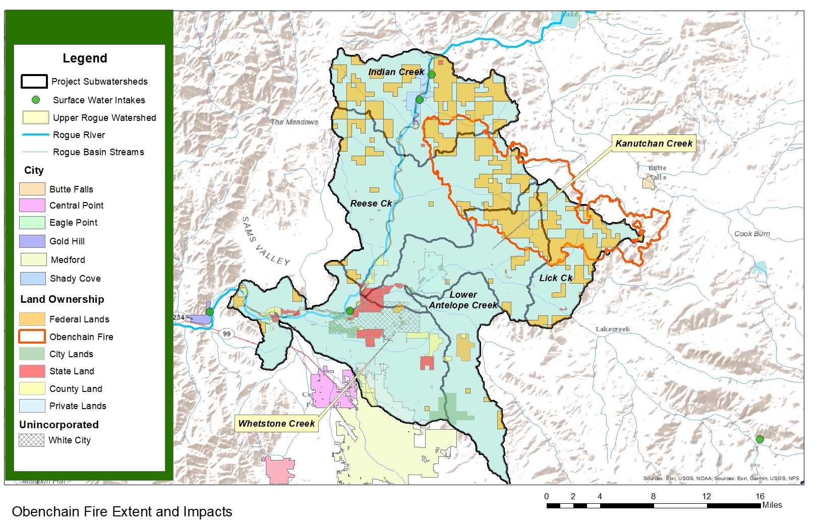
This page contains information on the National Water Quality Inventory project being conducted for NRCS by the Rogue River Watershed Council and Rogue Valley Council of Governments.

Phase I – October 2020 – January 2021

  • Collected data and produced GIS Map
  • Created report outlining basic conditions.

Phase II – February 2021-October 2021

Deliverables and Links

Online Project Map (Working Draft)

Close Menu

Rogue Valley Council of Governments